 and Adelaide on St. Vincent Gulf (at top)")
WIKIARCHIVES.SPACE
The Human Spaceflight Archive


Information
- Taken in
- Space
- Author
- NASA
- Description
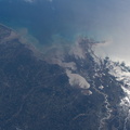
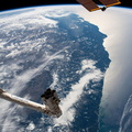
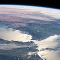
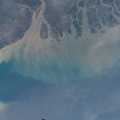
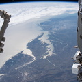
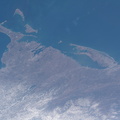
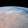
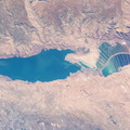
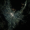
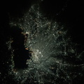
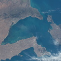
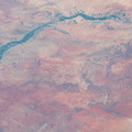
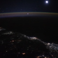
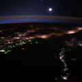
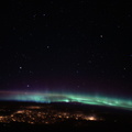
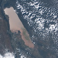
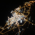
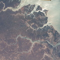
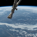
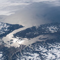
- The International Space Station was orbiting 271 miles above Tasmania when this photograph was taken of the southeastern coast of Australia. Landmarks in this picture include the cities of Melbourne on Port Phillip Bay (lower center) and Adelaide on St. Vincent Gulf (at top)
- Created on
- Sunday 15 March 2020
- Albums
- ISS (WIP) / EXPEDITIONS / EXPEDITION 62
- Source link
- https://www.flickr.com/photos/nasa2explore/albums/72157709993523452
- Visits
- 85
- Rating score
- no rate
- Rate this photo
- License
- CC BY-NC-ND
- Modified by WikiArchives
- No (original)
- Downloads
- 0
EXIF Metadata
NIKON CORPORATION NIKON D5
- Make
- NIKON CORPORATION
- Model
- NIKON D5
- DateTimeOriginal
- 2020:03:15 23:28:32
- ApertureFNumber
- f/14.0
Powered by Piwigo