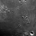
 lies east of Fayetteville in the vegetated, rolling hills and broad cultivated valleys that characterize south-central Tennessee. In dramatic contrast are the dark, vegetated mountains of the larger northeast-southwest-trending Cumberland Plateau. Discernible are northern Huntsville, Alabama (upper left corner), and U. S. Highway 231/431 (top of photograph) that connects Huntsville and Fayetteville.")
WIKIARCHIVES.SPACE
The Human Spaceflight Archive


Information
- Taken in
- Space
- Author
- NASA
- Description
- U-shaped, light sediment-laden Tims Ford Lake (right center) lies east of Fayetteville in the vegetated, rolling hills and broad cultivated valleys that characterize south-central Tennessee. In dramatic contrast are the dark, vegetated mountains of the larger northeast-southwest-trending Cumberland Plateau. Discernible are northern Huntsville, Alabama (upper left corner), and U. S. Highway 231/431 (top of photograph) that connects Huntsville and Fayetteville.
- Created on
- Source link
- https://www.flickr.com/photos/nasa2explore/9365213271/in/album-72157634790274619/
- Visits
- 133
- Rating score
- no rate
- Rate this photo
- License
- CC BY-NC
- Modified by WikiArchives
- No (original)
- Downloads
- 0
Powered by Piwigo