
WIKIARCHIVES.SPACE
The Human Spaceflight Archive
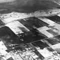
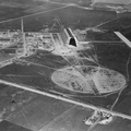
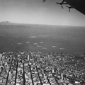
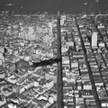
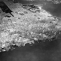
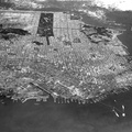
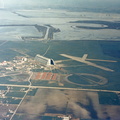
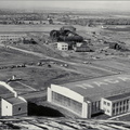
Navy Aerial of San Francisco, California; looking west across South Beach - China Basin to Golden Gate Park, includes Richmond District, Sea Cliff, Presidio, Marina, Fisherman's Wharf, and Telegraph Hill. - Note the beginings of the Golden Gate Bridge in the upper right and the Bay Bridge construction in the lower right of the image.


Information
- Taken in
- Other
- Author
- NASA
- Description
-
Navy Aerial of San Francisco, California; looking west across South Beach - China Basin to Golden Gate Park, includes Richmond District, Sea Cliff, Presidio, Marina, Fisherman's Wharf, and Telegraph Hill. - Note the beginings of the Golden Gate Bridge in the upper right and the Bay Bridge construction in the lower right of the image.
- Created on
- Wednesday 17 July 1935
- Albums
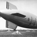
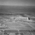
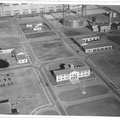
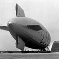
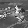
- US SPACE PROGRAM / FACILITIES / AMES RESEARCH CENTER
- Source link
- https://images.nasa.gov/search?q=the&page=1&media=image,video,audio&yearStart=1920&yearEnd=1940
- Visits
- 33
- Rating score
- no rate
- Rate this photo
- License
- Public Domain
- Modified by WikiArchives
- No (original)
- Downloads
- 0
Powered by Piwigo