
WIKIARCHIVES.SPACE
The Human Spaceflight Archive


Information
- Taken in
- Space
- Author
- NASA
- Description
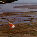
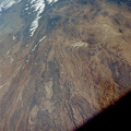
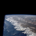
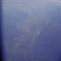
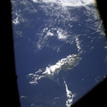
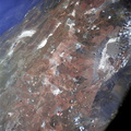
- This view of South America was photographed from the Apollo 7 spacecraft during its 81st revolution of Earth from an altitude of 120 nautical miles. The port city of Antofagasta, Chile, is located in the half-moon shaped bay in the lower left portion of the picture. Beyond the coast is the Andean peak of Llullaillaco Volcano which rises 22,000 feet above sea level. At left center is the Chuquicamata copper mines located near Coloma. At the center of the photo, behind the large salt lake and atop a 19,000 foot high volcano, the countries of Bolivia, Argentina, and Chile meet at a common point. Below the clouds in the upper portion of the photo are the Great Plains known as the Gran Chaco.
- Created on
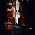
- Thursday 17 October 1968
- Albums
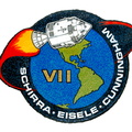
- US SPACE PROGRAM / APOLLO / APOLLO 7 / Mission Photos (Edited)
- Source link
- https://www.flickr.com/photos/nasa2explore/9344622215/in/album-72157634756224714/
- Visits
- 113
- Rating score
- no rate
- Rate this photo
- License
- Public Domain
- Modified by WikiArchives
- No (original)
- Downloads
- 0
Powered by Piwigo