 during its first flight in April 1994 and its second flight in October 1994. The area shown is approximately 40 by 80 kilometers (25 by 50 miles). North is toward the upper left of the image. The colors indicate the displacement of the surface in that direction that the radar instrument was pointed (toward the right of the image) in the six months between images. The analysis of ground movement is preliminary, but appears consistent with the motions detected by the Global Positioning System ground receivers that have been used over the past five years. The south flank of the Kilauea volcano is among the most rapidly deforming terrain's on Earth. Several regions show motion over the six-month time period. Most obvious is at the base of Hilina Pali, where 10 centimeters (4 inches) or more of crustal deformation can be seen in a concentrated area near the coastline. On a more localized scale, the currently active Pu'u O'o summit also shows about 10 centimeters (4 inches) of change near the vent area. Finally, there are indications of additional movement along the upper southwest rift zone, just below the Kilauea caldera in the image. Deformation of the south flank is believed to be the result of movements along faults deep beneath the surface of the volcano, as well as injections of magma, or molten rock, into the volcano's plumbing system. Detection of ground motions from space has proven to be a unique capability of imaging radar technology. Scientists hope to use deformation data acquired by SIR-C/X-SAR and future imaging radar missions to help in better understanding the processes responsible for volcanic eruptions and earthquakes. Spaceborne Imaging Radar-C/X-Band Synthetic Aperture Radar (SIR-C/X-SAR) is part of NASA's Mission to Planet Earth. (P-44753)")
WIKIARCHIVES.SPACE
The Human Spaceflight Archive


Information
- Taken in
- Space
- Author
- NASA
- Description
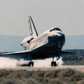
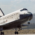
- This is a deformation map of the south flank of Kilauea volcano on the big island of Hawaii, centered at 19.5 degrees north latitude and 155.25 degrees west longitude. The map was created by combining interferometric radar data - that is data acquired on different passes of the Space Shuttle Endeavour which are then overlaid to obtain elevation information - acquired by the Spaceborne Imaging Radar-C/X-Band Synthetic Aperture Radar (SIR-C/X-SAR) during its first flight in April 1994 and its second flight in October 1994. The area shown is approximately 40 by 80 kilometers (25 by 50 miles). North is toward the upper left of the image. The colors indicate the displacement of the surface in that direction that the radar instrument was pointed (toward the right of the image) in the six months between images. The analysis of ground movement is preliminary, but appears consistent with the motions detected by the Global Positioning System ground receivers that have been used over the past five years. The south flank of the Kilauea volcano is among the most rapidly deforming terrain's on Earth. Several regions show motion over the six-month time period. Most obvious is at the base of Hilina Pali, where 10 centimeters (4 inches) or more of crustal deformation can be seen in a concentrated area near the coastline. On a more localized scale, the currently active Pu'u O'o summit also shows about 10 centimeters (4 inches) of change near the vent area. Finally, there are indications of additional movement along the upper southwest rift zone, just below the Kilauea caldera in the image. Deformation of the south flank is believed to be the result of movements along faults deep beneath the surface of the volcano, as well as injections of magma, or molten rock, into the volcano's "plumbing" system. Detection of ground motions from space has proven to be a unique capability of imaging radar technology. Scientists hope to use deformation data acquired by SIR-C/X-SAR and future imaging radar missions to help in better understanding the processes responsible for volcanic eruptions and earthquakes. Spaceborne Imaging Radar-C/X-Band Synthetic Aperture Radar (SIR-C/X-SAR) is part of NASA's Mission to Planet Earth. (P-44753)
- Created on
- Monday 10 October 1994
- Albums
- US SPACE PROGRAM / SPACE SHUTTLE / MISSIONS / STS-68 / Mission Photos (Edited)
- Source link
- https://www.flickr.com/photos/nasa2explore/9730927327/in/album-72157635500240228/
- Visits
- 106
- Rating score
- no rate
- Rate this photo
- License
- CC BY-NC
- Modified by WikiArchives
- No (original)
- Downloads
- 0
Powered by Piwigo