
WIKIARCHIVES.SPACE
The Human Spaceflight Archive


Information
- Taken in
- Space
- Author
- NASA
- Description
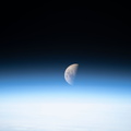
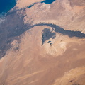
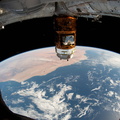
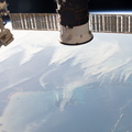
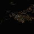
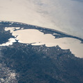
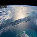
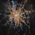
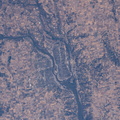
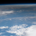
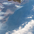
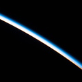
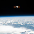
- Lake Guiers and the Senegal River separating the African nations of Senegal and Mauritania are pictured as the International Space Station orbited 257 miles in altitude off the Atlantic coast.
- Created on
- Friday 29 November 2019
- Albums
- ISS (WIP) / EXPEDITIONS / EXPEDITION 61
- Source link
- https://www.flickr.com/photos/nasa2explore/albums/72157704730697552
- Visits
- 23
- Rating score
- no rate
- Rate this photo
- License
- CC BY-NC-ND
- Modified by WikiArchives
- No (original)
- Downloads
- 0
EXIF Metadata
NIKON CORPORATION NIKON D5
- Make
- NIKON CORPORATION
- Model
- NIKON D5
- DateTimeOriginal
- 2019:11:29 14:54:25
- ApertureFNumber
- f/11.0
Powered by Piwigo