 occupies a T-shaped peninsula and strip of land separating the Mediterranean from Lake Mariout. According to NASA scientists studying the Expedition 1 photo collection, the town was originally built upon a mole (stone breakwater) called Heptastadium, which joined the island of Pharos to the mainland. Since then, the scientists say, sedimentary deposits have added considerably to the width of the mole.
Since 1905, when the city’s 370 thousand inhabitants lived in an area of about four square kilometers between the two harbors, the city (population 4 million) has grown beyond its medieval walls and now occupies an area of about 300 square kilometers. The Mahmudiya Canal, connecting Alexandria with the Nile, runs to the south of the city and, by a series of locks, enters the harbor of the principal port of Egypt (note ships). The reddish and ochre polygons west of Lake Mariout are salt-evaporation, chemical-storage, and water-treatment ponds within the coastal lagoon.")
WIKIARCHIVES.SPACE
The Human Spaceflight Archive
This Nadir view of Alexandria, Egypt, was provided by a digital still camera image down linked from the International Space Station to flight controllers in Houston. Alexandria (Al Iskandariya) occupies a T-shaped peninsula and strip of land separating the Mediterranean from Lake Mariout. According to NASA scientists studying the Expedition 1 photo collection, the town was originally built upon a mole (stone breakwater) called Heptastadium, which joined the island of Pharos to the mainland. Since then, the scientists say, sedimentary deposits have added considerably to the width of the mole.


Information
- Taken in
- Author
- NASA
- Description
-
This Nadir view of Alexandria, Egypt, was provided by a digital still camera image down linked from the International Space Station to flight controllers in Houston. Alexandria (Al Iskandariya) occupies a T-shaped peninsula and strip of land separating the Mediterranean from Lake Mariout. According to NASA scientists studying the Expedition 1 photo collection, the town was originally built upon a mole (stone breakwater) called Heptastadium, which joined the island of Pharos to the mainland. Since then, the scientists say, sedimentary deposits have added considerably to the width of the mole.
Since 1905, when the city’s 370 thousand inhabitants lived in an area of about four square kilometers between the two harbors, the city (population 4 million) has grown beyond its medieval walls and now occupies an area of about 300 square kilometers. The Mahmudiya Canal, connecting Alexandria with the Nile, runs to the south of the city and, by a series of locks, enters the harbor of the principal port of Egypt (note ships). The reddish and ochre polygons west of Lake Mariout are salt-evaporation, chemical-storage, and water-treatment ponds within the coastal lagoon.
- Created on
- Albums
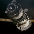
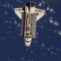
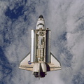
- ISS (WIP) / EXPEDITIONS / EXPEDITION 01
- Source link
- https://www.flickr.com/photos/nasa2explore/albums/72157635001704566/
- Visits
- 92
- Rating score
- no rate
- Rate this photo
- License
- CC BY-NC
- Modified by WikiArchives
- No (original)
- Downloads
- 0
Powered by Piwigo