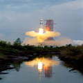
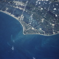
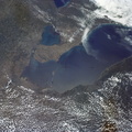
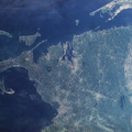
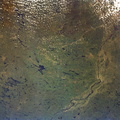
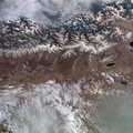
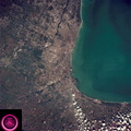
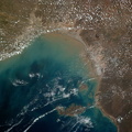
. Portions of Minnesota, Michigan and Ontario, Canada are in the scene. The Duluth metropolitan area is at the west end of the lake. The discoloration plume in the water at Duluth is the result of tailings from the iron ore smelters that process the iron ore from the nearby open pit mines seen near the upper left corner of the photo.")
WIKIARCHIVES.SPACE
The Human Spaceflight Archive


Information
- Taken in
- Space
- 作者
- NASA
- 描述
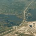
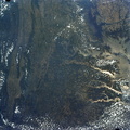
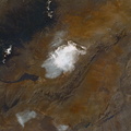
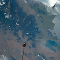
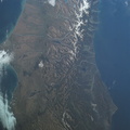
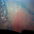
- This view shows the west end of Lake Superior and Duluth, MN (47.0N, 91.0W). Portions of Minnesota, Michigan and Ontario, Canada are in the scene. The Duluth metropolitan area is at the west end of the lake. The discoloration plume in the water at Duluth is the result of tailings from the iron ore smelters that process the iron ore from the nearby open pit mines seen near the upper left corner of the photo.
- 创建于
- 星期五 22 六月 1973
- Source link
- https://www.flickr.com/photos/nasa2explore/11086430785/in/album-72157634791373199/
- 访问量
- 107
- 评价得分
- 没有评分
- 评分
- License
- CC BY-NC
- Modified by WikiArchives
- No (original)
- 下载
- 0
技术支持 Piwigo