
WIKIARCHIVES.SPACE
The Human Spaceflight Archive


Information
- Taken in
- Space
- Author
- NASA
- Description
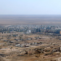
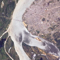
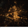
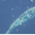
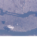
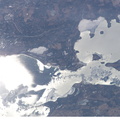
- Dallas, Texas is featured in this image photographed by an Expedition 10 crew member on the International Space Station. The Dallas-Fort Worth metropolitan area is the largest in Texas with an approximate population of 6 million people in 2005. Founded by John Neely Bryan in 1841, the city became the center for the United States oil economy with the discovery of oilfields to the east of the city in 1930. The Dallas-Forth Worth region today is a major corporate, banking, and technological center. This image captures the northwestern portion of the metropolitan area. Standing water bodies such as Lake Lewisville and Grapevine Lake are highlighted by sunglint, where the surface of the water acts as a mirror reflecting sunlight back towards the astronauts on the Station. Using the sunglint to define edges of water helps when mapping water bodies and stream courses on a landscape – note the region of small ponds to the north of Grapevine Lake highlighted by sunglint.
- Created on
- Thursday 14 April 2005
- Albums
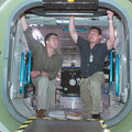
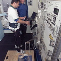
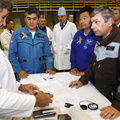
- ISS (WIP) / EXPEDITIONS / EXPEDITION 10
- Source link
- https://www.flickr.com/photos/nasa2explore/albums/72157634802502630
- Visits
- 20
- Rating score
- no rate
- Rate this photo
- License
- CC BY-NC-ND
- Modified by WikiArchives
- No (original)
- Downloads
- 0
Powered by Piwigo